Metadata
Place and Movement Network
- Title
- Place and Movement Network
- Alternative Title
- P&M, Place, Movement,
- Dataset Language
- eng
- Abstract
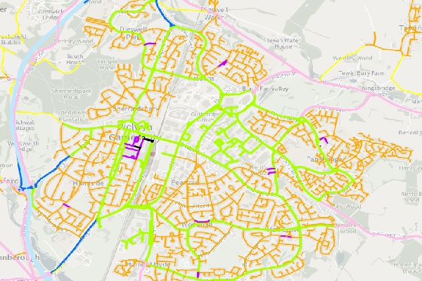
- Place and Movement is a technical approach for recognising the needs of different road users and managing the interfaces between them.
The Hertfordshire network has been mapped into 9 place and movement categories based on factors such as land use, road type and whether it is in a rural or urban area. Further validation of the categories is ongoing following a series of workshops. The file creation date is stored in the attibutes in the "Data Version" column. Please note in June 2022 this network is now built on Ordnance Survey RAMI network and is no longer link to the old Ordnance Survey ITN network. - This dataset is used, queried and symbolised in different ways; altenate layers explained below.
- Topic Category
- Place and Movement
- Keyword
- Keyword Value: Transport
Originating Controlled Vocabulary: GEMET - INSPIRE Spatial Data Themes (GEMET)
Originating Controlled Vocabulary Citation: 2008-01-01 - Temporal Extent
- from -- to -2022-06-01
- Dataset Reference Date
- Date: -2022-06-01
Date Type:Revision - Lineage
-
Dataset maintained by the Transport Planning and Data team
The data within this is routinely maintained from information received from District Councils, Traffic Orders, Adoption agreements and National Street Gazetteer updates.
IPR:
Product: OS MasterMap, OS Highways
Date: - Extent
- Hertfordshire County
- Vertical Extent
- -
- Spatial Reference System
- OSGB36 - National Grid of Great Britain
- Spatial Resolution
- 1m
- Resource Locator
- Public Webmap Viewer: Traffic Information Webmap Viewer
- Internal viewer for HCC staff: Highways Webmaps-extra Viewer
- Layerfile for use by HCC internal staff: Access via Portal
- Format
- ESRI/SDE
- Responsible Organisation
- Hertfordshire County Council
Email :Gary Beaumont@hertfordshire.gov.uk
Role: Resource Provider, Custodian, Owner, Originator, Point of Contact - Limitations on Public Access
- This dataset uses OS premium products so OS License agreements must be adered to
- Use Constraints
- Copyright controlled Ordnance Survey Derived Data. Use is subject to licence.
-
You must use the appropriate Copyright Acknowledgements below in all outputs using this dataset;
For internal use:©Crown copyright and database rights Ordnance Survey AC0000849954.
©Place and Movement version 6 - June 2022
For external use:©Crown copyright and database rights Ordnance Survey AC0000849954.
©Place and Movement version 6 - June 2022
You are not permitted to copy, sub-licence, distribute or sell any of this data to third parties in any form.
For Publicly Available Electronic Copies the following must also be added:- The HCC Watermark;
- The phrase: "Use of this data is subject to terms and conditions." set out in a legible font and conspicuous position must form a clear hyperlink to https://gisinfo.hertfordshire.gov.uk/os/copyright.htm
- This data is supplied without guarantee or any warranty as to the accuracy, currency or completeness, and is provided as is, excluding any warranties of any kind, either express or implied, to the fullest extent permitted by law, including (but not limited to) satisfactory quality or fitness for a particular purpose.
- Additional information
- The Place and Movement Dataset can be viewed in various ways and filtered and queried
- Place and Movement
(The Full Dataset)
This shows the Place and Movement status of all the maintained Roads. All Footpaths and other paths will not be shown - Resource Identifier
- PlaceandMovement
- Conformity
- Commission Regulation (EU) No 1089/2010 of 23 November 2010 implementing Directive
2007/2/EC of the European Parliament and of the Council as regards interoperability of
spatial data sets and services.
2010-12-08
notEvaluated
Re-designing HCC Data for INSPIRE not done - Equivalent scale
- Bounding box
- 0.76, 0.22, 51.58, 52.10
- Quality scope
- Dataset
- Spatial representation type
- vector
- Character encoding
- UTF-8
- Data quality
- -
- Maintenance information
- maintenance and update frequency: 6 monthly
- update scope: This layer will only be updated if staff identify secions of the network to be changed. These will then be checked against the criteria for each Place and Movement Type
- maintenance note: This layer only is updated 6 monthly if there are changes to be made
- Metadata update date
- 2023-06-01
- Metadata Language
- English
- Metadata Point of Contact
- Hertfordshire County Council - Corporate GIS Team
Email :gis@hertfordshire.gov.uk - Resource Type
- 6 Dataset
- File Identifier
- Place and Movement
- Hierarchy level name
- dataset
- Parent identifier
- -
- Metadata standard name
- UK GEMINI
- Metadata standard version
- 2.3
- Review date
- -
- Attributes
-
Name Long Name Description
- OSGB36 National Grid Bounding Coordinates
- West: 486000 East: 552000 North: 245000 South: 189000
- More Information
- Change History