Metadata
Traffic Survey - Adhoc Traffic Survey
- Title
- Traffic Survey - Adhoc Traffic Survey
- Alternative Title
- Traffic, Ad Hoc, Traffic Surveys
- Dataset Language
- eng
- Abstract
- Place and Movement is a technical approach for recognising the needs of different road users and managing the interfaces between them.
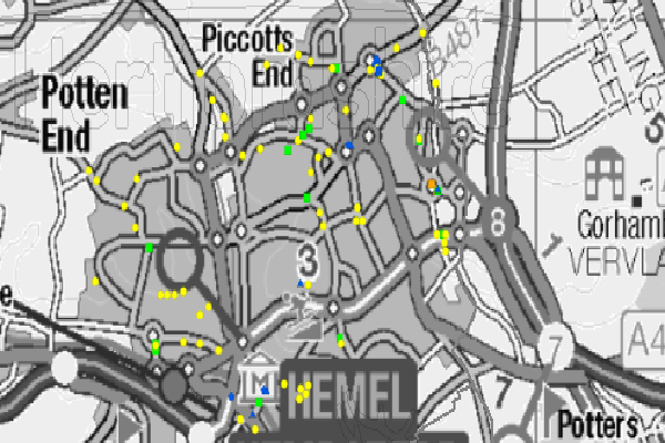
Various types of traffic surveys carried out on the Hertfordshire Road network, carried out in the last 5 years. From speed and volume counts to manual classified counts and pedestrian surveys. Each survey is bespoke for the original requester and therefore may differ from survey to survey. The date range can be queired using the date field in the attribute table - This dataset is symbolised by survey type.
- Topic Category
- Transportation
- Keyword
- Keyword Value: Transport
Originating Controlled Vocabulary: GEMET - INSPIRE Spatial Data Themes (GEMET)
Originating Controlled Vocabulary Citation: 2008-01-01 - Temporal Extent
- Data from last 5 years to present
- Dataset Reference Date
- Date: 20/09/2023
Date Type: Revision - Lineage
-
Dataset maintained by the custodians with the Highways Transport Planning and Data Team.
The data within this is routinely maintained from surveys carried out across the network
IPR:
Product: OS MasterMap
Date: - Extent
- Hertfordshire County
- Vertical Extent
- -
- Spatial Reference System
- OSGB36 - National Grid of Great Britain
- Spatial Resolution
- 1m
- Resource Locator
- Public Webmap Viewer: Traffic Information Webmap Viewer
- Internal viewer for HCC staff: Highways Webmaps-extra Viewer
- Layerfile for use by HCC internal staff: Access via Portal
- Format
- ESRI/SDE
- Responsible Organisation
- Hertfordshire County Council
Email :Gary Beaumont@hertfordshire.gov.uk
Email :David Hart@hertfordshire.gov.uk
Role: Resource Provider, Custodian, Owner, Originator, Point of Contact - Limitations on Public Access
- otherRestrictions
- Use Constraints
- Copyright controlled Ordnance Survey Derived Data. Use is subject to licence.
-
You must use the appropriate Copyright Acknowledgement;
For internal use:©Crown copyright and database rights Ordnance Survey AC0000849954.
For external use:©Crown copyright and database rights Ordnance Survey AC0000849954.
You are not permitted to copy, sub-licence, distribute or sell any of this data to third parties in any form.
For Publicly Available Electronic Copies the following must also be added:- The HCC Watermark;
- The phrase: "Use of this data is subject to terms and conditions." set out in a legible font and conspicuous position must form a clear hyperlink to https://gisinfo.hertfordshire.gov.uk/os/copyright.htm
- This data is supplied without guarantee or any warranty as to the accuracy, currency or completeness, and is provided as is, excluding any warranties of any kind, either express or implied, to the fullest extent permitted by law, including (but not limited to) satisfactory quality or fitness for a particular purpose.
- Additional information
- The Traffic Survey - Adhoc Traffic Survey can be viewed in various ways.
- Traffic Survey - Adhoc Traffic Survey
(The Full Dataset)
This shows Adhoc Traffic Surveys within the date period shown above. The survey has a reference number for which data can be requested by contacting David.Hart@hertfordshire.gov.uk - Resource Identifier
- Traffic Survey - Adhoc Traffic Survey
- Conformity
- Commission Regulation (EU) No 1089/2010 of 23 November 2010 implementing Directive
2007/2/EC of the European Parliament and of the Council as regards interoperability of
spatial data sets and services.
2010-12-08
notEvaluated
Re-designing HCC Data for INSPIRE not done - Equivalent scale
- Bounding box
- 0.76, 0.22, 51.58, 52.10
- Quality scope
- Dataset
- Spatial representation type
- vector
- Character encoding
- UTF-8
- Data quality
- -
- Maintenance information
- maintenance and update frequency: 3 monthly
- update scope: This layer will be quarterly and based on input surveys
- maintenance note:
- Metadata update date
- 2023-01-05
- Metadata Language
- English
- Metadata Point of Contact
- Hertfordshire County Council - Corporate GIS Team
Email :gis@hertfordshire.gov.uk - Resource Type
- 6 Dataset
- File Identifier
- Programmed Bicycle Survey
- Hierarchy level name
- dataset
- Parent identifier
- -
- Metadata standard name
- UK GEMINI
- Metadata standard version
- 2.3
- Review date
- -
- Attributes
-
Name Long Name Description
- OSGB36 National Grid Bounding Coordinates
- West: 486000 East: 552000 North: 245000 South: 189000
- More Information
- Change History