Metadata
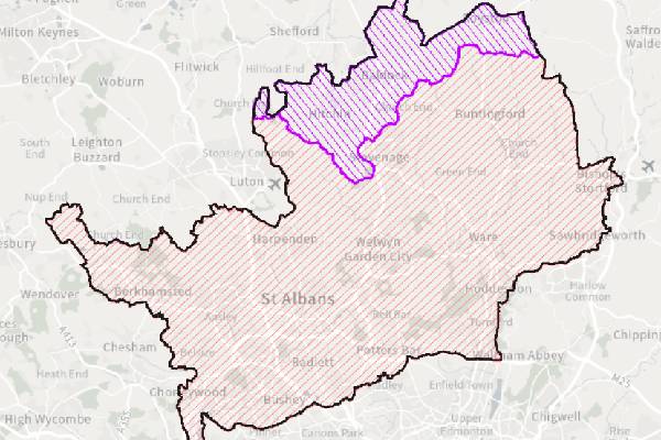
Water & Sewage Company Operational Areas
- Title
- Water & Sewage Company Operational Areas
- Alternative Title
- Water & Sewage Operational Areas
-
- Dataset Language
- eng
- Abstract
-
Ofwat produces a digial representation of the water and sewage undertaker boundaries.The definitive legal record of water supply and sewerage services
areas remains in maps and other information set out in the appointments of companies as water and/or sewerage undertakers and subsequent area variations.
- Topic Category
- environment
- Keyword
- Keyword Value: Water, Sewage, Operational Areas
Originating Controlled Vocabulary: GEMET - INSPIRE Spatial Data Themes (GEMET)
Originating Controlled Vocabulary Citation: 2008-01-01
- Temporal Extent
- from -1960- to -2013-04
- Dataset Reference Date
- Date:2011-08-10 -2013-04
Date Type:publication, revision
- Lineage
- This data is provided by the Ofwat, which HCC take a copy of. The data is released under the Open Government Licence,
and the latest data can be obtained by emailing mailbox@ofwat.gov.uk and asking for a shapefile.
IPR:
Product:
Date:
- Extent
- Hertfordshire County
- Vertical Extent
- -
- Spatial Reference System
- OSGB36 - National Grid of Great Britain
- Spatial Resolution
- 1m
- Resource Locator
-
- Within the floodmanareas service
- Format
- ESRI/SDE
- Responsible Organisation
- Ofwat
Please email mailbox@ofwat.gov.uk. for any queries.
- Limitations on Public Access
- Open Government Licence, allowing worldwide, royalty-free, perpetual, non-exclusive licence to use the Information subject to including the below copyright acknowledgement.
- Use Constraints
- This data is released under the Open Governent Licence. You must use the below Copyright Acknowledgement;
Contains public sector information licensed under the Open Government Licence v3.0.
- Additional information
- Resource Identifier
- Conformity
- Commission Regulation (EU) No 1089/2010 of 23 November 2010 implementing Directive 2007/2/EC of the European Parliament and of the Council
as regards interoperability of spatial data sets and services.
2010-12-08
notEvaluated
Re-designing HCC Data for INSPIRE not done
- Equivalent scale
- Bounding box
- 0.76, 0.22, 51.58, 52.10
- Quality scope
- Dataset
- Spatial representation type
- vector
- Character encoding
- UTF-8
- Data quality
- -
- Maintenance information
- maintenance and update frequency:unknown
- update scope:
- maintenance note:
- Metadata update date
- -2021-11-29
- Metadata Language
- English
- Metadata Point of Contact
- Hertfordshire County Council - Corporate GIS Team
Email :gis@hertfordshire.gov.uk
- Resource Type
- 6 Dataset
- File Identifier
- Hierarchy level name
- dataset
- Parent identifier
- -
- Metadata standard name
- UK GEMINI
- Metadata standard version
- 2.3
- Review date
- -
- Attributes
-
| Name |
Long Name |
Description |
|
|
|
|
|
|
|
|
|
|
|
|
|
|
|
|
|
|
|
|
|
- OSGB36 National Grid Bounding Coordinates
- West: 486000 East: 552000
North: 245000 South: 189000
- More Information
- Change History