Metadata
Environmental Stewardship Scheme Agreements (England)
- Title
- Environmental Stewardship Scheme Agreements (England)
- Alternative Title
- ESS
- Dataset Language
- eng
- Abstract
- This data is published on behalf of the Rural Payments Agency. For further information about this data contact GI_Services_Technica@rpa.gov.uk.
Environmental Stewardship Scheme (England) holdings agreement polygons (includes farm business and payment info). More information about the scheme and guidance can be viewed here.
Please note: This is a legacy scheme, and as a result there are no longer any Entry Level Stewardship (ELS) only agreements or Organic Entry Level Stewardship (OELS) only agreements in this dataset as ELS and OELS where only 5 year agreements.Full metadata can be viewed on data.gov.uk. - Topic Category
- Keyword
- Keyword Value: Environment, LandUse, OpenData, Area management, restriction, regulation zones, reporting units
Originating Controlled Vocabulary: GEMET - INSPIRE Spatial Data Themes (GEMET)
Originating Controlled Vocabulary Citation: 2008-01-01 - Temporal Extent
- from -2005-03-18 to -2099-12-31
- Dataset Reference Date
- Date:2005-03-18 -2021-06-01
Date Type:creation, revision - Lineage
-
IPR:
Product:
Date: - Extent
- National
- Vertical Extent
- -
- Spatial Reference System
- OSGB36 - National Grid of Great Britain
- Spatial Resolution
- 1m
- Resource Locator
-
Resource locator
http://naturalengland-defra.opendata.arcgis.com/datasets/environmental-stewardship-scheme-agreements-england
protocol: WWW:LINK-1.0-http--link
name:
description: ArcGIS Open Dataset record page
https://environment.data.gov.uk/spatialdata/environmental-stewardship-scheme-agreements-england/wms
protocol: OGC:WMS
name:
description: Environmental Stewardship Scheme Agreements (England) WMS
https://environment.data.gov.uk/spatialdata/environmental-stewardship-scheme-agreements-england/wfs
protocol: OGC:WFS
name:
description: Environmental Stewardship Scheme Agreements (England) WFS
https://environment.data.gov.uk/DefraDataDownload/?mapService=NE/EnvironmentalStewardshipSchemeAgreements&Mode=spatial
protocol: DSP:ESRI
name:
description: Environmental Stewardship Scheme Agreements (England) Download <\dd>- Layerfile for use by HCC internal staff:\\geodata\NatEng\Env_Stwrd
- Format
- ESRI/SDE
- Responsible Organisation
- Rural Payments Agency
Email :open.data@rpa.gov.uk
Role: Point of Contact. - Limitations on Public Access
- There are no public access constraints to this data. Use of this data is subject to the licence identified.
- Use Constraints
- This data is supplied without guarantee or any warranty as to the accuracy, currency or completeness,
and is provided as is, excluding any warranties of any
kind, either express or implied, to the fullest extent permitted by law,including (but not limited to) satisfactory quality or fitness for a particular purpose.
- Additional information
- Resource Identifier
- Conformity
- Commission Regulation (EU) No 1089/2010 of 23 November 2010 implementing Directive 2007/2/EC of the European Parliament and of the Council
as regards interoperability of spatial data sets and services.
2010-12-08
notEvaluated
Re-designing HCC Data for INSPIRE not done - Equivalent scale
- Bounding box
- -7.05, 2.07, 55.81, 49.95
- Quality scope
- Dataset
- Spatial representation type
- vector
- Character encoding
- UTF-8
- Data quality
- -
- Maintenance information
- maintenance and update frequency:
- update scope:
- maintenance note:
- Metadata update date
- -2021-07
- Metadata Language
- English
- Metadata Point of Contact
- Rural Payments Agency
Email :open.data@rpa.gov.uk
Role: Point of Contact. - Resource Type
- 6 Dataset
- File Identifier
- Hierarchy level name
- dataset
- Parent identifier
- -
- Metadata standard name
- UK GEMINI
- Metadata standard version
- 2.3
- Review date
- -
- Attributes
-
Name Long Name Description
- OSGB36 National Grid Bounding Coordinates
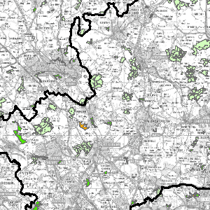
- West: 486000 East: 552000 North: 245000 South: 189000
- More Information
- Change History
All Data Derived from 1st of April 2018 reports and March 2018 Rural Land Register (LPIS). Holdings boundaries are derived from Rural Land Register parcels, which are derived from Ordnance Survey MasterMap Topography layer.
Open Government Licence
<