Data Representation - conveying information on a map
Geographic features are the things located on or near the surface of the Earth. Geographic features can occur naturally (rivers, vegetation), be constructed (roads, pipelines, buildings), or could be notional entities such as subdivisions of land (counties, land parcels, political divisions).
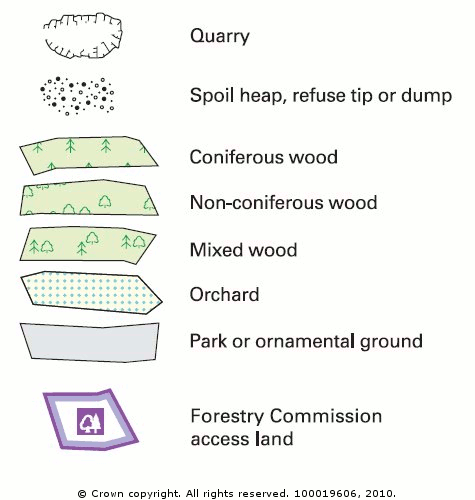
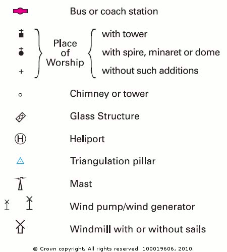
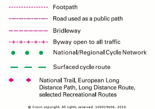
Maps convey descriptive information about geographic features using symbols and labels. Roads are drawn with various widths, patterns and colours to represent different road classes (e.g. motorways in wide solid blue lines and primary roads in thin solid red lines). Streams and water bodies are typically drawn in blue, and special symbols denote specific features such as railway stations and airports. City streets are labelled with names and often with address ranges; special buildings are labelled with their names or function. These geographic features are all represented in maps by using three types of feature class: points, lines and polygons (areas).
Points
Points define discrete locations of geographic features too small to be depicted as lines or areas at a small scale, for example telegraph poles or well locations. Points can also represent locations that have no area at all such as mountain peaks or spot heights.
Lines
Lines represent the shapes of geographic features too narrow to be depicted as areas, such as streams or railway lines. Lines also represent linear features that have length but no area, such as contours or road centre lines.
Polygons
Polygons are closed shapes (areas) that represent geographic features that have a definite area, such as counties, land parcels, soil types or land use zones.