Metadata
Vector Map Local
- Title
- Vector Map Local
- Alternative Title
- VML
- Dataset Language
- eng
- Abstract
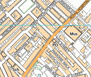
- Buildings, Rivers OS VectorMap Local is a simple vector dataset at a nominal scale of 1:10000 covering the whole of Great Britain that has been designed for creating graphical mapping.
The product can be used as mapping in its own right or can be used to provide a flexible geographic context reference for customers’ overlay information. As well as the vector dataset, a number of output styles are suggested. The main characteristics of
the dataset is representation of real world features (e.g. roads, railways, buildings, vegetation, boundaries and urban extents) as points, lines, polygons, and text. - Topic Category
- imageryBaseMapsEarthCover
- Keyword
- Keyword Value: VectorMapLocal
Originating Controlled Vocabulary: GEMET - INSPIRE Spatial Data Themes (GEMET)
Originating Controlled Vocabulary Citation: 2008-01-01 - Temporal Extent
- from unknown to unknown
- Dataset Reference Date
- Date: --
Date Type: - Lineage
-
IPR:
Product:
Date: - Extent
- Great Britain
- Vertical Extent
- -
- Spatial Reference System
- OSGB36 - National Grid of Great Britain
- Spatial Resolution
- 1m
- Resource Locator
- Layerfile for use by HCC internal staff:\Geodata\OS\VectorMapLocal\
- Ordnance Survey Product Page
- Format
- TIFF with LZW compression
- Responsible Organisation
- Ordnance Survey Customer Services
Email :customerservices@os.uk
Role: Resource Provider, Custodian, Owner, Distributor, Originator, Point of Contact, Processor, Publisher, Author. - Limitations on Public Access
- otherRestrictions
- Use Constraints
- Copyright controlled Ordnance Survey Derived Data. Use is subject to licence.
- You must use the appropriate Copyright Acknowledgement;
For internal use:©Crown copyright and database rights Ordnance Survey 100019606.
For external use:© Crown copyright and database rights Ordnance Survey 100019606.
You are not permitted to copy, sub-licence, distribute or sell any of this data to third parties in any form.
For Publicly Available Electronic Copies the following must also be added:- The HCC Watermark;
- The phrase: "Use of this data is subject to terms and conditions." set out in a legible font and conspicuous position must form a clear hyperlink to the Ordnance Survey Copyright
- Use limitation dependent upon licence from Ordnance Survey
- This data is supplied without guarantee or any warranty as to the accuracy, currency or completeness,
and is provided as is, excluding any warranties of any kind, either express or implied, to the fullest extent permitted by law, including (but not limited to) satisfactory quality or fitness for a particular purpose. - Licensing and agreements Choose the best Ordnance Survey licence for you.
- Additional information
- Resource Identifier
- Conformity
- Commission Regulation (EU) No 1089/2010 of 23 November 2010 implementing Directive 2007/2/EC of the European Parliament and of the Council
as regards interoperability of spatial data sets and services.
2010-12-08
notEvaluated
Re-designing HCC Data for INSPIRE not done - Equivalent scale
- Bounding box
- 0.76, 0.22, 51.58, 52.10
- Quality scope
- Dataset
- Spatial representation type
- vector
- Character encoding
- UTF-8
- Data quality
- -
- Maintenance information
- maintenance and update frequency:
- update scope:
- maintenance note:
- Metadata update date
- --
- Metadata Language
- English
- Metadata Point of Contact
- Ordnance Survey Customer Services
Email :customerservices@os.uk
Role: Resource Provider, Custodian, Owner, Distributor, Originator, Point of Contact, Processor, Publisher, Author. - Resource Type
- 6 Dataset
- File Identifier
- Hierarchy level name
- dataset
- Parent identifier
- -
- Metadata standard name
- UK GEMINI
- Metadata standard version
- 2.3
- Review date
- -
- Attributes
-
Name Long Name Description
- OSGB36 National Grid Bounding Coordinates
- West: 486000 East: 552000 North: 245000 South: 189000
- More Information
- Change History
Use of the data is available to any organisation that is a member of the PSGA (Public Sector Geospatial Agreement) or any UK academic institution via Edina's subscription Digimap service. It is not currently commercially available.