Metadata
*Ancient Woodland (England)
- Title
- Ancient Woodland (England)
- Alternative Title
- Ancient Woodland Inventory (AWI)
- Dataset Language
- eng
- Abstract
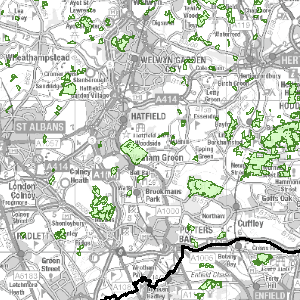
- The inventory identifies over 52,000 ancient woodland sites in England. Ancient woodland is identified using presence or absence of woods from old maps, information about the wood's name,
shape, internal boundaries, location relative to other features, ground survey, and aerial photography. The information recorded about each wood and stored on the Inventory Database includes its grid reference, its area in hectares and how much is semi-natural or replanted.
Prior to the digitisation of the boundaries, only paper maps depicting each ancient wood at 1:50 000 scale were available. Attribution statement: © Natural England copyright. Contains Ordnance Survey data © Crown copyright and database right [year]. - Topic Category
- environment
- Keyword
- Keyword Value:OpenData, Environment, Habitats and Biotopes
Originating Controlled Vocabulary: GEMET - INSPIRE Spatial Data Themes (GEMET)
Originating Controlled Vocabulary Citation: 2008-01-01 - Temporal Extent
- from -- to --
- Dataset Reference Date
- Date: -2021-04-15
Date Type: revision - Lineage
- The information recorded about each wood and stored on the Inventory Database includes its grid reference, its area in hectares and how much is semi-natural or replanted.
Prior to the digitisation of the boundaries, only paper maps depicting each ancient wood at 1:50 000 scale were available. -
IPR:
Product:
Date: - Extent
- National
- Vertical Extent
- -
- Spatial Reference System
- OSGB36 - National Grid of Great Britain
- Spatial Resolution
- 1m
- Resource Locator
-
https://environment.data.gov.uk/spatialdata/ancient-woodland-england/wms
protocol: WMS
name: AncientWoodlandEngland_WMS
description: Ancient Woodland (England) WMS
https://environment.data.gov.uk/DefraDataDownload/?mapService=NE/AncientWoodlandEngland&Mode=spatial
protocol: DSP:ESRI
name: AncientWoodlandEngland_Download
description: Ancient Woodland (England) Download
https://environment.data.gov.uk/spatialdata/ancient-woodland-england/wfs
protocol: WFS
name: AncientWoodlandEngland_WFS
description: Ancient Woodland (England) WFS
https://naturalengland-defra.opendata.arcgis.com/datasets/ancient-woodland-england
protocol: WWW:LINK-1.0-http--link
name: ArcGIS Open Dataset record page
description: ArcGIS Open Dataset record page
https://s3-eu-west-1.amazonaws.com/data.defra.gov.uk/Natural_England/Habitat_Species/Habitats/Ancient_Woodland_England_NE/Ancient_Woodland_England_Docs.zip
protocol: WWW:LINK-1.0-http--link
name: Guidance documents
description: Guidance documents <\dd>- Layerfile for use by HCC internal staff: \\geodata\NatEng\AncWoodland
- Format
- ESRI/SDE
- Responsible Organisation
- Natural England
Email :data.services@naturalengland.org.uk
Role: Resource Provider, Custodian, Owner, Originator, Point of Contact, Processor, Publisher, Author. - Limitations on Public Access
- There are no public access constraints to this data. Use of this data is subject to the licence identified.
- Use Constraints
- This data is supplied without guarantee or any warranty as to the accuracy, currency or completeness,
and is provided as is, excluding any warranties of any
kind, either express or implied, to the fullest extent permitted by law,including (but not limited to) satisfactory quality or fitness for a particular purpose.
- Additional information
- Resource Identifier
- Conformity
- Commission Regulation (EU) No 1089/2010 of 23 November 2010 implementing Directive 2007/2/EC of the European Parliament and of the Council
as regards interoperability of spatial data sets and services.
2010-12-08
notEvaluated
Re-designing HCC Data for INSPIRE not done - Equivalent scale
- Bounding box
- -6.375, 1.79, 55.82, 49.9
- Quality scope
- Dataset
- Spatial representation type
- vector
- Character encoding
- UTF-8
- Data quality
- -
- Maintenance information
- maintenance and update frequency: monthly
- update scope:
- maintenance note:
- Metadata update date
- -2021-07
- Metadata Language
- English
- Metadata Point of Contact
- Natural England
Email :data.services@naturalengland.org.uk
Role: Resource Provider, Custodian, Owner, Originator, Point of Contact, Processor, Publisher, Author. - Resource Type
- 6 Dataset
- File Identifier
- Hierarchy level name
- dataset
- Parent identifier
- -
- Metadata standard name
- UK GEMINI
- Metadata standard version
- 2.3
- Review date
- -
- Attributes
-
Name Long Name Description
- OSGB36 National Grid Bounding Coordinates
- West: 486000 East: 552000 North: 245000 South: 189000
- More Information
- Change History
-->
Open Government Licence