Metadata
Mineral Extraction Sites
- Title
- MineralExtractionSites
- Alternative Title
- Mineral Extraction Sites, MES
- Dataset Language
- eng
- Abstract
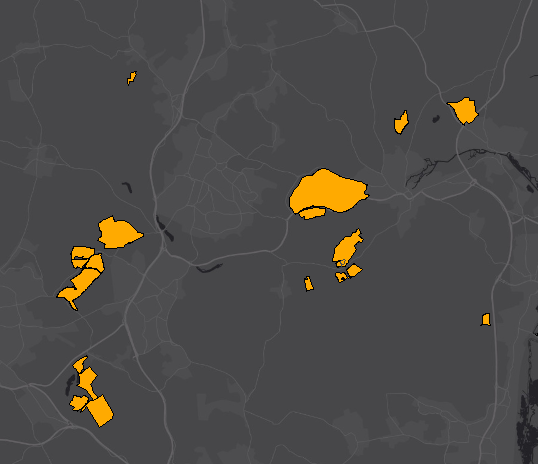
- Existing mineral extraction sites in March 2007 as shown in the Minerals Local Plan (adopted March 2007).
These include sand and gravel sites, clay sites and chalk sites which have planning permission for extraction of reserves. - Topic Category
- geoscientificInformation
- Keyword
- Keyword Value:Extraction Sites, Geology, Hertfordshire, MCA, MCA2007, Minerals Resources,
Originating Controlled Vocabulary: GEMET - INSPIRE Spatial Data Themes (GEMET)
Originating Controlled Vocabulary Citation: 2008-01-01 - Temporal Extent
- from -2007-03-27 to --
- Dataset Reference Date
- Date:2021-11-20 --
Date Type: publication - Lineage
-
IPR:Ordnance Survey
Product:1:10,000 Raster
Date:2007
IPR:Ordnance Survey
Product:MasterMap
Date:2007
IPR:Ordnance Survey
Product:Landline
Date:2007 - Extent
- Hertfordshire County
- Vertical Extent
- -
- Spatial Reference System
- OSGB36 - National Grid of Great Britain
- Spatial Resolution
- 1m
- Resource Locator
- Layerfile for use by HCC internal staff:\\Geodata\HCC\Environ\Minerals\MLP_Adopted2007\MLP 2007 Extraction Sites (inc. Plant Site).lyr,\\Geodata\HCC\Environ\Minerals\MLP_Adopted2007\MLP 2007 Extraction Sites and Preferred Areas as Points.lyr, \\Geodata\HCC\Environ\Minerals\MLP_Adopted2007\MLP 2007 Extraction Sites with Plant Site shown.lyr, \\Geodata\HCC\Environ\Minerals\MLP_Adopted2007\MLP 2007 Extraction Sites.lyr
- Format
- ESRI/SDE, ESRI/Shape file
- Responsible Organisation
- Hertfordshire County Council - Environment and Infrastructure
Email :daniel.clark@hertfordshire.gov.uk
Role: Resource Provider, Custodian, Point of Contact. - Limitations on Public Access
- Copyright Controlled. Use is subject to licence.
- Use Constraints
- You must use the appropriate Copyright Acknowledgement;
For internal use:©Crown copyright and database rights Ordnance Survey AC0000849954.
For external use:© Crown copyright and database rights Ordnance Survey AC0000849954.
You are not permitted to copy, sub-licence, distribute or sell any of this data to third parties in any form.
For Publicly Available Electronic Copies the following must also be added:- The HCC Watermark;
- The phrase: "Use of this data is subject to terms and conditions." set out in a legible font and conspicuous position must form a clear hyperlink to the Ordnance Survey Copyright
- Additional information
- Resource Identifier
- Conformity
- Commission Regulation (EU) No 1089/2010 of 23 November 2010 implementing Directive 2007/2/EC of the European Parliament and of the Council
as regards interoperability of spatial data sets and services.
2010-12-08
notEvaluated
Re-designing HCC Data for INSPIRE not done - Equivalent scale
- Bounding box
- 0.76, 0.22, 51.58, 52.10
- Quality scope
- Dataset
- Spatial representation type
- vector
- Character encoding
- UTF-8
- Data quality
- -
- Maintenance information
- maintenance and update frequency:notPlanned
- update scope:
- maintenance note:
- Metadata update date
- -2021-11-19
- Metadata Language
- English
- Metadata Point of Contact
- Hertfordshire County Council - Corporate GIS Team
Email :gis@hertfordshire.gov.uk - Resource Type
- 6 Dataset
- File Identifier
- Hierarchy level name
- dataset
- Parent identifier
- -
- Metadata standard name
- UK GEMINI
- Metadata standard version
- 2.3
- Review date
- -
- Attributes
-
Name Long Name Description
- OSGB36 National Grid Bounding Coordinates
- West: 486000 East: 552000 North: 245000 South: 189000
- More Information
- Change History
Identified and digitised by the County Development Unit, based on planning applications (stored in Applicat).
The data contains British Geological Survey intelectual property © NERC. All rights Reserved. Based upon 1:50,000 geological maps, with the permission of the British Geological Survey.