Metadata
HCC Flood Incident Records
- Title
- HCC Flood Indicent Records
- Alternative Title
- Flood Incident, Flooding, FIR
- Dataset Language
- eng
- Abstract
-
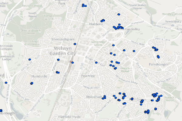
This layer shows locations where flooding has been confirmed. Following significant rainfall events (with reports made regarding flooding), flood questionnaire surveys are used to confirm the extent.
These, along with data from a variety of sources, are combined and transposed into GIS for the FIR.
HCC became a Lead Local Flood Authority in 2010, since then it has developed and maintained this Flood Incident Record. We hold limited details about flooding incidents prior to 2010. If an area is not coverered by the FIR map it does not mean that the area has ne er flooded, only that we do not currently have records of flooding in this area. Data is not displayed to identify individual properties. - Topic Category
- environment
- Keyword
- Keyword Value: Flood Incident, Flooding, Hertfordshire
Originating Controlled Vocabulary: GEMET - INSPIRE Spatial Data Themes (GEMET)
Originating Controlled Vocabulary Citation: 2008-01-01 - Temporal Extent
- Ongoing
- Dataset Reference Date
- Date: 22/11/2023
Date Type: Revision - Lineage
- Data is maintained by the Flood Risk Management Team. Flooding is first confirmed at a site, and then this data is combined with other sources and transposed into GIS.
Data is updated as-and-when, depending on when additional data is aquired or reviewed.
IPR:
Product:
Date: - Extent
- Hertfordshire County
- Vertical Extent
- -
- Spatial Reference System
- OSGB36 - National Grid of Great Britain
- Spatial Resolution
- 1m
- Resource Locator
- Within 2 services: floodriskman & floodriskmanextra
- Format
- ESRI/SDE
- Responsible Organisation
- Hertfordshire County Council - Environment & Transport / Sustainable Growth
Email :FloodandWaterManagement@hertfordshire.gov.uk
Role: Resource Provider, Custodian, Owner, Distributor, Originator, Point of Contact,Author. - Limitations on Public Access
- Copyright Controlled. Use is subject to licence.
- Use Constraints
- You must use the appropriate Copyright Acknowledgement;
For internal use:©Crown copyright and database rights Ordnance Survey 100019606.
For external use:© Crown copyright and database rights Ordnance Survey 100019606.
You are not permitted to copy, sub-licence, distribute or sell any of this data to third parties in any form.
For Publicly Available Electronic Copies the following must also be added:- The HCC Watermark;
- The phrase: "Use of this data is subject to terms and conditions." set out in a legible font and conspicuous position must form a clear hyperlink to the Ordnance Survey Copyright
-->
- This data is supplied without guarantee or any warranty as to the accuracy, currency or completeness,
and is provided as is, excluding any warranties of any
kind, either express or implied, to the fullest extent permitted by law,including (but not limited to) satisfactory quality or fitness for a particular purpose.
- Additional information
- Resource Identifier
- Conformity
- Commission Regulation (EU) No 1089/2010 of 23 November 2010 implementing Directive 2007/2/EC of the European Parliament and of the Council
as regards interoperability of spatial data sets and services.
2010-12-08
notEvaluated
Re-designing HCC Data for INSPIRE not done - Equivalent scale
- Bounding box
- 0.76, 0.22, 51.58, 52.10
- Quality scope
- Dataset
- Spatial representation type
- vector
- Character encoding
- UTF-8
- Data quality
- -
- Maintenance information
- maintenance and update frequency:unknown
- update scope:
- maintenance note:
- Metadata update date
- -2021-11-29
- Metadata Language
- English
- Metadata Point of Contact
- Hertfordshire County Council - Corporate GIS Team
Email :gis@hertfordshire.gov.uk - Resource Type
- 6 Dataset
- File Identifier
- Hierarchy level name
- dataset
- Parent identifier
- -
- Metadata standard name
- UK GEMINI
- Metadata standard version
- 2.3
- Review date
- -
- Attributes
-
Name Long Name Description
- OSGB36 National Grid Bounding Coordinates
- West: 486000 East: 552000 North: 245000 South: 189000
- More Information
- Change History
Use of the data is not currently commercially available.