Metadata
Landscape Character Areas
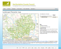
- Title
- LandscapeCharacterAreas
- Alternative Title
- Landscape Character Areas, LCA
- Dataset Language
- eng
- Abstract
- Landscape character is defined as 'a distinct, recognisable and consistent pattern of elements in the landscape that makes one landscape different from another, rather than better or worse'. Put simply, landscape character is that which makes an area unique.
The Hertfordshire Landscape Character Area data has been developed to support better decision-making with regard to landscape conservation and management and development planning and management.
Maps have been used to record analysts', field surveyors' and consultees' views and the landscape has been subdivided into areas which have an 'identity', typically linked to physical or cultural factors,
but which may simply be recognised as such by local communities. These areas are described in detail in landscape character area statements. The statements can be used by developers,
their agents and planners and charitable bodies to help guide development and landscape change to be more sustainable. Developers' agents and charities in particular may find it helpful to have the boundaries as GIS data to use in their own systems.
Landscape Character Assessment has been undertaken widely in one form or another since the 1970s,
however the current coverage of landscape character assessment across the country derives from government and government agency policy in the 1990s. A hierarchy of scale is found helpful,
and the Hertfordshire Landscape Character Assessment provides local detail to support the broad National Character Area statements being prepared by Natural England for similar purposes.
Landscape Character Areas boundaries do not consistently follow any one landscape element, although field boundaries are frequently used.
Some urban areas are excluded from the surrounding Landscape Character Areas because they are predominately urban in character (and are recorded as "No Landscape Character Area" in the data). - Topic Category
- environment
- Keyword
- Keyword Value:Countryside Conservation, Landscape, Landscape Character Areas, LCA, Hertfordshire
Originating Controlled Vocabulary: GEMET - INSPIRE Spatial Data Themes (GEMET)
Originating Controlled Vocabulary Citation: 2008-01-01 - Temporal Extent
- from -- to --
- Dataset Reference Date
- Date:2000 -2009
Date Type: publication, revision - Lineage
- South Herts (2000)
- St. Albans (2001)
- Dacorum (2003)
- East Herts (2004)
- Welwyn Hatfield (2005)
- North Herts (2006)
-
IPR:Ordnance Survey
Product: 1;10000 Raster Image
Date:2009
IPR: Hertfordshire County Council's Intellectual Property Rights - Extent
- Hertfordshire County
- Vertical Extent
- -
- Spatial Reference System
- OSGB36 - National Grid of Great Britain
- Spatial Resolution
- 1m
- Resource Locator
- Layerfile for use by HCC internal staff:\\Geodata\HCC\Environ\HBRC\LCA\Landscape Character Areas.Lyr
- Format
- ESRI/SDE, ESRI#&47; Shape file
- Responsible Organisation
- Hertfordshire County Council - Corporate GIS Team
Email :gis@hertfordshire.gov.uk
Role: Resource Provider, Custodian, Owner, Distributor, Originator, Point of Contact, Processor, Publisher, Author. - Limitations on Public Access
- Open Government Licence for public sector information.
- Use Constraints
- This data is supplied without guarantee or any warranty as to the accuracy, currency or completeness,
and is provided as is, excluding any warranties of any
kind, either express or implied, to the fullest extent permitted by law,including (but not limited to) satisfactory quality or fitness for a particular purpose.
- Additional information
-
Information about Landescape Character from Natural England: LandscapeCharacterArea
Landscape of Hertfordshire - character assessment (hertsdirect.org):Character Assessments - Resource Identifier
- Conformity
- Commission Regulation (EU) No 1089/2010 of 23 November 2010 implementing Directive 2007/2/EC of the European Parliament and of the Council
as regards interoperability of spatial data sets and services.
2010-12-08
notEvaluated
Re-designing HCC Data for INSPIRE not done - Equivalent scale
- Bounding box
- 0.76, 0.22, 51.58, 52.10
- Quality scope
- Dataset
- Spatial representation type
- vector
- Character encoding
- UTF-8
- Data quality
- -
- Maintenance information
- maintenance and update frequency:Unknown
- update scope:
- maintenance note:
- Metadata update date
- -2021-11-24
- Metadata Language
- English
- Metadata Point of Contact
- Hertfordshire County Council - Corporate GIS Team
Email :gis@hertfordshire.gov.uk - Resource Type
- 6 Dataset
- File Identifier
- Hierarchy level name
- dataset
- Parent identifier
- -
- Metadata standard name
- UK GEMINI
- Metadata standard version
- 2.3
- Review date
- -
- Attributes
-
Name Long Name Description
- OSGB36 National Grid Bounding Coordinates
- West: 486000 East: 552000 North: 245000 South: 189000
- More Information
- Change History
Originally there were 6 files, created at different times:
These were combined and additional Non-Landscape Character Areas created for the urban areas to give full coverage for the county.
Boundaries were re-digitised and mered to the 1:10,00 Scale Raster data, at a viewing scale of 1:2,000.
Licenced on terms equivalent to OS OpenData;
You must use the following Copyright Acknowledgement:
Contains public sector information from Hertfordshire County Council.
Licensed on terms equivalent to OS OpenData.
Contains Ordnance Survey data © Crown copyright and database right 2012
See: http://www.ordnancesurvey.co.uk/oswebsite/docs/licences/os-opendata-licence.pdf
Users should note that the data is not intended to be used as definitive but indicative.
This data is supplied without guarantee or any warranty as to the accuracy, currency or completeness, and is provided as is, excluding any warranties of any kind,
either express or implied, to the fullest extent permitted by law, including (but not limited to) satisfactory quality or fitness for a particular purpose.
Contains public sector information licensed under the Open Government Licence v3.0. See http://www.nationalarchives.gov.uk/doc/open-government-licence/version/3/