Metadata
Three Tier School
- Title
- Three TieSchools
- Alternative Title
- Sch3Tier, 3Tier, ThreeTier
- Dataset Language
- eng
- Abstract
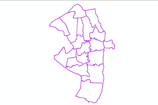
- In Hertfordshire there are both a 2 tier education system of Primary and Secondary schools, and a three tier system,
consisting First, Middle and Upper Schools. This file identifies those areas which are 3 tier.
If a child lives in a 3 tier area, for some admissions processes, a different logic for calculating their nearest school will be used. - Topic Category
- society
- Keyword
- Keyword Value: Schools
Originating Controlled Vocabulary: GEMET - INSPIRE Spatial Data Themes (GEMET)
Originating Controlled Vocabulary Citation: 2008-01-01 - Temporal Extent
- from 2007-03-21 to 2021-05-25
- Dataset Reference Date
- Date: 2021-05-25
Date Type: revision - Lineage
- Created using BoundaryLine Parish data.
IPR: Ordnance Sur
Product: Boundary line
Date: 2021 - Extent
- Hertfordshire County
- Vertical Extent
- -
- Spatial Reference System
- OSGB36 - National Grid of Great Britain
- Spatial Resolution
- 1m
- Resource Locator
- Shape file for use by HCC internal staff: \Geodata\HCC\Educat\3tier\ESRI
- Format
- ESRI/Shape file
- Responsible Organisation
- Hertfordshire County Council - Corporate GIS Team
Email :gis@hertfordshire.gov.uk
Role: Resource Provider, Custodian, Owner, Distributor, Originator, Point of Contact, Processor, Publisher, Author.
- Hertfordshire County Council - Childrens Services
Email :Stacey.Harriott@hertfordshire.gov.uk
Role: Resource Provider, Custodian, Point of Contact. - Limitations on Public Access
- licence
- Use Constraints
- Licence:Open Government Licence
- You must use the following Copyright Acknowledgement:
Contains OS data © Crown copyright and database right
- This data is supplied without guarantee or any warranty as to the accuracy, currency or completeness,
and is provided as is, excluding any warranties of any
kind, either express or implied, to the fullest extent permitted by law,including (but not limited to) satisfactory quality or fitness for a particular purpose.
- Additional information
- Resource Identifier
- Sch3Tier
- Conformity
- Commission Regulation (EU) No 1089/2010 of 23 November 2010 implementing Directive 2007/2/EC of the European Parliament and of the Council
as regards interoperability of spatial data sets and services.
2010-12-08
notEvaluated
Re-designing HCC Data for INSPIRE not done - Equivalent scale
- Bounding box
- 0.76, 0.22, 51.58, 52.10
- Quality scope
- Dataset
- Spatial representation type
- vector
- Character encoding
- UTF-8
- Data quality
- -
- Maintenance information
- maintenance and update frequency: unknown
- update scope: dataset
- maintenance note:
- Metadata update date
- 2021-06-02
- Metadata Language
- English
- Metadata Point of Contact
- Hertfordshire County Council - Corporate GIS Team
Email :gis@hertfordshire.gov.uk - Resource Type
- 6 Dataset
- File Identifier
- Hierarchy level name
- dataset
- Parent identifier
- -
- Metadata standard name
- UK GEMINI
- Metadata standard version
- 2.3
- Review date
- -
- Attributes
-
Name Long Name Description NAME Parish Name Parish Name CODE GSS Code The Code for the Parish Area HECTARES Hectares The Area of the Parish ThreeTier The Parish has 3 Tier Schools A Binary (1) for this Parish
- OSGB36 National Grid Bounding Coordinates
- West: 486000 East: 552000 North: 245000 South: 189000
- More Information
- Change History
- 2021-05
Parish Boundaries updated for 2020 changes in East Herts. - 2018-09-08
The Dacoram Parishes were removed - each of these schools have converted to 2 tier