Metadata
Integrated Services for Learning Areas
- Title
- ISL
- Alternative Title
- ISL, ANA
- Dataset Language
- eng
- Abstract
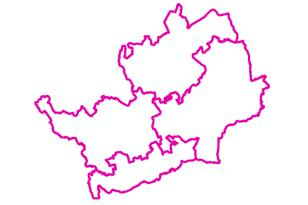
- The delivery of early intervention and targeted support for children with additional and special educational needs in Hertfordshire is provided through actual, local, multi-professional teams, called the Integrated Services for Learning (ISL). There are 5 nominal areas matched to corresponding DSPL ‘areas’.
- Topic Category
- Society, Location
- Keyword
- Keyword Value: Schools, School types
Originating Controlled Vocabulary: Integrated Public Sector Vocabulary (IPSV)
Originating Controlled Vocabulary Citation: Version 2.00 - 2012-08-05
Keyword Value: Utility and governmental services
Originating Controlled Vocabulary: GEMET - INSPIRE Spatial Data Themes (GEMET)
Originating Controlled Vocabulary Citation: 2008-06-01 - Temporal Extent
- from 2013-11-18 to 2017-11-17
- Dataset Reference Date
- Date: 2017-11-17
Date Type: Revision - Lineage
- Originally created at LSOA level for the Perfomance Monitoring Team; these were termed "Analytical Notional Areas"
A couple of the schools do not work in the "correct" areas however (due to the size of the LSOAs), so in order to make the maps, a second dataset was made using OutPut Areas - these were "Illustrative Notional Areas".
The Illustrative Notional Areas were archived in 2017, when the areas were changed and they became co-incident.
IPR: National Statistics Census Geographies
Product: Lower Super Output Areas
Date: 2013
IPR: Hertfordshire County Council's Intellectual Property Rights - Extent
- Hertfordshire County
- Vertical Extent
- -
- Spatial Reference System
- OSGB36 - National Grid of Great Britain
- Spatial Resolution
- 1m
- Resource Locator
- Public Viewer: Children's Services Map
- Layerfile for user by HCC internal staff:\Geodata\HCC\Educat\CSSi>
- Format
- ESRI/SDE
ESRI/Shape file - Responsible Organisation
- Hertfordshire County Council - Corporate GIS Team
Email :gis@hertfordshire.gov.uk
Role: Resource Provider, Custodian, Owner, Distributor, Originator, Point of Contact, Processor, Publisher, Author.
Stuart Bayer
Integrated Services for Learing
Children's Services
Email :Stuart.Bayer@hertfordshire.gov.uk
Role: Custodian - 011 notPlanned
- Limitations on Public Access
- Copyright Controlled. Use is subject to licence.
- Use Constraints
- Licence:Open Government Licence
- You must use the following Copyright Acknowledgement:
Contains National Statistics data © Crown copyright and database right 2013
See: http://www.nationalarchives.gov.uk/doc/open-government-licence/open-government-licence.htm
Contains Ordnance Survey data © Crown copyright and database right 2013 - This data is supplied without guarantee or any warranty as to the accuracy, currency or completeness, and is provided as is, excluding any warranties of any kind, either express or implied, to the fullest extent permitted by law, including (but not limited to) satisfactory quality or fitness for a particular purpose.
- Additional information
- Resource Identifier
- DSPL_OA; DSPL_LSOA
- Conformity
- Commission Regulation (EU) No 1089/2010 of 23 November 2010 implementing Directive
2007/2/EC of the European Parliament and of the Council as regards interoperability of
spatial data sets and services.
2010-12-08
notEvaluated
Re-designing HCC Data for INSPIRE not done - Equivalent scale
- 3000
- Bounding box
- -0.71, 0.19, 51.62, 52.06
- Quality scope
- Dataset
- Spatial representation type
- Vector
- Character encoding
- UTF-8
- Data quality
- -
- Maintenance information
- maintenance and update frequency: unknown
update scope: feature
maintenance note: When informed by the ISL Team - Metadata update date
- 2021-05-25
- Metadata Language
- English
- Metadata Point of Contact
- Hertfordshire County Council - Corporate GIS Team
Email :gis@hertfordshire.gov.uk - Resource Type
- 6 Dataset
- File Identifier
- ISL
- Hierarchy level name
- ISL
- Parent identifier
- -
- Metadata standard name
- UK GEMINI
- Metadata standard version
- 2.3
- Review date
- -
- Attributes
-
Name Long Name Description ISL_NO ISL Number The Integrated Services for Learning Number for the area that the DSPL falls within ISL_NM ISL Name The Integrated Services for Learning Name (a Geographical Description) for the area that the DSPL falls within ISL_ALT< ISL Code A code that can be sorted Alphabetically
- OSGB36 National Grid Bounding Coordinates
- West: 486000 East: 552000 North: 245000 South: 189000
- More Information
- Change History