Metadata
Family Centre Reporting Localities
- Title
- Family Centre Reporting Localities
- Alternative Title
- FCReporting, FCSReportingLocalities
- Dataset Language
- eng
- Abstract
- Family Centres have been set up so that parents have a place where they can
access information and support with child-related issues.
The Localities were developed to facilitate needs analysis - Topic Category
- Society, Location
- Keyword
- Keyword Value: Children
Originating Controlled Vocabulary: Integrated Public Sector Vocabulary (IPSV)
Originating Controlled Vocabulary Citation: Version 2.00 - 2012-08-05
Keyword Value: Utility and governmental services
Originating Controlled Vocabulary: GEMET - INSPIRE Spatial Data Themes (GEMET)
Originating Controlled Vocabulary Citation: 2008-06-01 - Temporal Extent
- from 2018-08-29 to 2019-05-22
- Dataset Reference Date
- Date: 2019-05-22
Date Type: Revision - Lineage
- Amalgamated LSOA Boundaries
IPR: National Statistics Census Geographies
Product: Lower Super Output Areas
Date: 2013
IPR: Hertfordshire County Council's Intellectual Property Rights - Extent
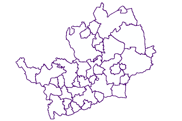
- Hertfordshire County
- Vertical Extent
- -
- Spatial Reference System
- OSGB36 - National Grid of Great Britain
- Spatial Resolution
- 1m
- Resource Locator
- Layerfile for user by HCC internal staff:\Geodata\HCC\Educat\FamilyCentres
- Format
- ESRI/SDE
- Responsible Organisation
- Hertfordshire County Council - Corporate GIS Team
Email :gis@hertfordshire.gov.uk
Role: Resource Provider, Custodian, Owner, Distributor, Originator, Point of Contact, Processor, Publisher, Author.
Jamie Leavy
Early Years
Children's Services
Email :Jamie.Leavy@hertfordshire.gov.uk
Role: Custodian - 011 notPlanned
- Limitations on Public Access
- Copyright Controlled. Use is subject to licence.
- Use Constraints
- Licence:Open Government Licence
- You must use the following Copyright Acknowledgement:
Contains National Statistics data © Crown copyright and database right 2013
See: http://www.nationalarchives.gov.uk/doc/open-government-licence/open-government-licence.htm
Contains Ordnance Survey data © Crown copyright and database right 2013 - This data is supplied without guarantee or any warranty as to the accuracy, currency or completeness, and is provided as is, excluding any warranties of any kind, either express or implied, to the fullest extent permitted by law, including (but not limited to) satisfactory quality or fitness for a particular purpose.
- Additional information
- Resource Identifier
- FamilyCentreQuadrants
- Conformity
- Commission Regulation (EU) No 1089/2010 of 23 November 2010 implementing Directive
2007/2/EC of the European Parliament and of the Council as regards interoperability of
spatial data sets and services.
2010-12-08
notEvaluated
Re-designing HCC Data for INSPIRE not done - Equivalent scale
- 3000
- Bounding box
- -0.71, 0.19, 51.62, 52.06
- Quality scope
- Series
- Spatial representation type
- Vector
- Character encoding
- UTF-8
- Data quality
- -
- Maintenance information
- maintenance and update frequency: unknown
update scope:
maintenance note: - Metadata update date
- 2021-06-03
- Metadata Language
- English
- Metadata Point of Contact
- Hertfordshire County Council - Corporate GIS Team
Email :gis@hertfordshire.gov.uk - Resource Type
- 6 Dataset
- File Identifier
- FamilyCentreReportingLocalities
- Hierarchy level name
- Dataset
- Parent identifier
- -
- Metadata standard name
- UK GEMINI
- Metadata standard version
- 2.3
- Review date
- -
- Attributes
-
Name Long Name Description FC_RL_Code Localitiy Code An Alphanumeric Code FC_RL_Name Locality Name A geographical description of the area FC_Qd_Code Quadrant Code An Alphanumeric Code FC_Qd_Name Quadrant Name A geographical description of the quadrant Cnty_Code County Code The GSS Code for Hertfordshire Cnty_Name County Hertfordshire
- OSGB36 National Grid Bounding Coordinates
- West: 486000 East: 552000 North: 245000 South: 189000
- More Information
- Change History