Metadata
Co-educational Parishes
- Title
- CoEducational Parishes
- Alternative Title
- CoEd Parishes, CoEducationalParishes_FURNS, CoEducationalParishes_Tribal
- Dataset Language
- eng
- Abstract
- These files are designed to help with the admission priorities. Some schools have defined "Priority Areas" for pupils.
Each of countie's Parishes have been grouped into areas for either the co-educational schools that have Priorty Areas or single-sex schools (due to there being fewer of these, many parishes will not be applicable for either a Boys' or Girls' school). - Topic Category
- Society, Location
- Keyword
- Keyword Value: Schools, School types
Originating Controlled Vocabulary: Integrated Public Sector Vocabulary (IPSV)
Originating Controlled Vocabulary Citation: Version 2.00 - 2012-08-05
Keyword Value: Utility and governmental services
Originating Controlled Vocabulary: GEMET - INSPIRE Spatial Data Themes (GEMET)
Originating Controlled Vocabulary Citation: 2008-06-01 - Temporal Extent
- from 2006-01-11 to 2021-05-22
- Dataset Reference Date
- Date: 2021-05-22
Date Type: Revision - Lineage
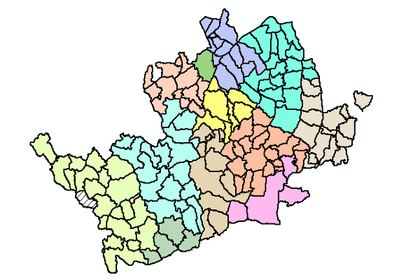
- Created using Parish boundaries. There are 6 Essex County Parishes included in the file:
Birchanger, Elsenham, Great Hallingbury,Little Hallingbury, Nazing and Sheering.
There are two versions of the file:
In the Admissions system (Serverlec "Synergy" System - previously, and still in file names "Tribal"), the out of county Parish of Ashley Green is also included, (for the Tring, Berkhamsted, Kings Langley, Hemel Hempstead and South West Herts Priority Area), and the rest of the Out of County Area is described as "No Parish"
In the file for the Publically available Find Your Nearest School, the Out of County Area is described as "out of County".
IPR: Ordnance Survey Boundary Line
Product: Parishes
Date: 2021
IPR: Hertfordshire County Council's Intellectual Property Rights - Extent
- Hertfordshire County
- Vertical Extent
- -
- Spatial Reference System
- OSGB36 - National Grid of Great Britain
- Spatial Resolution
- 1m
- Resource Locator
- Find Your Nearest School - Hertfordshire County Council Website
- Layerfile for user by HCC internal staff:\Geodata\HCC\Educat\CoEdParishes
- Format
- ESRI/SDE
ESRI/Shape file - Responsible Organisation
- Hertfordshire County Council - Corporate GIS Team
Email :gis@hertfordshire.gov.uk
Role: Resource Provider, Custodian, Owner, Distributor, Originator, Point of Contact, Processor, Publisher, Author. - David Court - Admissions and Transport
Email :david.court@hertfordshire.gov.uk
Role: Custodian - 011 notPlanned
- Limitations on Public Access
- Copyright Controlled. Use is subject to licence.
- Use Constraints
- Licence:Open Government Licence
- You must use the following Copyright Acknowledgement:
Contains OS data © Crown copyright and database right
- This data is supplied without guarantee or any warranty as to the accuracy, currency or completeness, and is provided as is, excluding any warranties of any kind, either express or implied, to the fullest extent permitted by law, including (but not limited to) satisfactory quality or fitness for a particular purpose.
- Additional information
- Resource Identifier
- CoEducationalParishes_FURNS, CoEducationalParishes_Tribal
- Conformity
- Commission Regulation (EU) No 1089/2010 of 23 November 2010 implementing Directive
2007/2/EC of the European Parliament and of the Council as regards interoperability of
spatial data sets and services.
2010-12-08
notEvaluated
Re-designing HCC Data for INSPIRE not done - Equivalent scale
- 3000
- Bounding box
- -0.71, 0.19, 51.62, 52.06
- Quality scope
- Dataset
- Spatial representation type
- Vector
- Character encoding
- UTF-8
- Data quality
- -
- Maintenance information
- maintenance and update frequency: unknown
update scope: feature
maintenance note: When informed by the ISL Team - Metadata update date
- 2021-06-01
- Metadata Language
- English
- Metadata Point of Contact
- Hertfordshire County Council - Corporate GIS Team
Email :gis@hertfordshire.gov.uk - Resource Type
- 6 Dataset
- File Identifier
- CoEducationalParishes
- Hierarchy level name
- dataset
- Parent identifier
- -
- Metadata standard name
- UK GEMINI
- Metadata standard version
- 2.3
- Review date
- -
- Attributes
-
Name Long Name Description NAME_2 Parish Parish Name (and out of county area for whole Country) COED_AREA CoEducational Area Description of Geographical Area BOYS Boys The Boys' school the Parish is within a priority area for GIRLS Girls The Girls' school the Parish is within a priority area for COEDINFO ISL Code The Name of the Schools for which the Parish is within a Priorty Area for - OSGB36 National Grid Bounding Coordinates
- West: 486000 East: 552000 North: 245000 South: 189000
- More Information
- Change History
- 2021-05
Files updated for East Herts Parish changes May 2020. - 2020-01
Ashley Green added to for the Admissions System - 2006-02-15
Presdales (Girls) Ware' deleted from Woolmer Green coedparish. - 2005-05-27
Edworth Parish added to Baldock and Villages coedparishes.