Metadata
The Council
- Title
- TheCouncil
- Alternative Title
- Council, Members, Electoral Deivisions
- Dataset Language
- eng
- Abstract
-
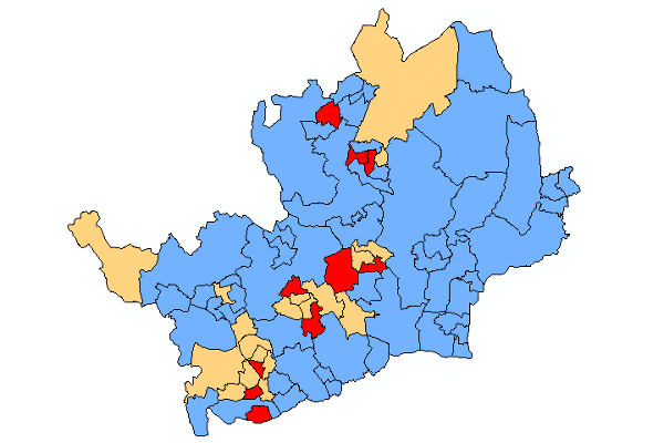
This shows the 78 Electoral Divisions within Hertfordshire.
It includes the currently elected Member for that Division as well as their Party.
Apart from the special cases of the Isles of Scilly and the Greater London Authority (GLA), the English county councils are the only type of local authority in the UK which does not use standard electoral (district) wards for electing councillors. Instead they use their own larger units, which are termed electoral divisions.
These county electoral divisions are confined within district boundaries, but need not be based on whole electoral (district) wards. In Hertfordshire there are a number of electoral divisions which include partial electoral (district) wards.
Like electoral wards, county electoral divisions are defined by the Boundary Committee for England (BCFE). - Topic Category
- Boundaries
- Keyword
- Keyword Value: Boundaries, Council, Councillors, Politics
Originating Controlled Vocabulary: GEMET - INSPIRE Spatial Data Themes (GEMET)
Originating Controlled Vocabulary Citation: 2008-01-01 - Temporal Extent
- from 2006-04-07to 2021-05-17
- Dataset Reference Date
- Date: -2021-05-01
Date Type: revision - Lineage
- Created using OS Boundary Line.
This file will be updated at each Election or if a seat becomes vacant (generally occuring after a Member's death, followed by a re-election)
IPR: Ordnance Survey
Product: BoundaryLine
Date: 2020
IPR: Hertfordshire County Council's Intellectual Property Rights - Extent
- Hertfordshire County
- Vertical Extent
- -
- Spatial Reference System
- OSGB36 - National Grid of Great Britain
- Spatial Resolution
- 1m
- Resource Locator
- Layerfile for use by HCC internal staff: \Geodata\HCC\Community
- The Council - Four Colour Map.lyr
- The Council - Political Affiliation.lyr
External Map Viewer - The Council - Format
- ESRI/SDE
- Responsible Organisation
- Hertfordshire County Council - Corporate GIS Team
Email :gis@hertfordshire.gov.uk
Role: Resource Provider, Custodian, Owner, Distributor, Originator, Point of Contact, Processor, Publisher, Author. - Limitations on Public Access
- Copyright Controlled. Use is subject to licence
- Use Constraints
- Licence:Open Government Licence
- You must use the following Copyright Acknowledgement:
Contains OS data © Crown copyright and database right
- This data is supplied without guarantee or any warranty as to the accuracy, currency or completeness, and is provided as is, excluding any warranties of any kind, either express or implied, to the fullest extent permitted by law, including (but not limited to) satisfactory quality or fitness for a particular purpose.
- Additional information
- Hertfordshire.gov.uk - Hertfordshire's County Councillors
- Resource Identifier
- TheCouncil
- Conformity
- Commission Regulation (EU) No 1089/2010 of 23 November 2010 implementing Directive 2007/2/EC of the European Parliament and of the Council
as regards interoperability of spatial data sets and services.
2010-12-08
notEvaluated
Re-designing HCC Data for INSPIRE not done - Equivalent scale
- Bounding box
- 0.76, 0.22, 51.58, 52.10
- Quality scope
- Dataset
- Spatial representation type
- vector
- Character encoding
- UTF-8
- Data quality
- -
- Maintenance information
- maintenance and update frequency:Infrequent
- update scope:
- maintenance note:
- Metadata update date
- 2021-06
- Metadata Language
- English
- Metadata Point of Contact
- Hertfordshire County Council - Corporate GIS Team
Email :gis@hertfordshire.gov.uk - Resource Type
- 6 Dataset
- File Identifier
- Hierarchy level name
- dataset
- Parent identifier
- -
- Metadata standard name
- UK GEMINI
- Metadata standard version
- 2.3
- Review date
- -
- Attributes
-
Name Long Name Description
- OSGB36 National Grid Bounding Coordinates
- West: 486000 East: 552000 North: 245000 South: 189000
- More Information
- Change History
- 2021-05-06: County Council Elections - new boundaries for 3 EDs in Bishop's Stortford following Ward and Parish Boundary Review in 2019
- 2017-05-05: After full boundary review, 78 Electoral Divisions are created and come into force on the day of the election
- 2013-05-02: 77 Electoral Divisions County Council Election: 46 Conservative, 16 Liberal Democrats and 15 Labour Councillors elected