Metadata
Ground Water Source Protection Zones [Merged]
- Title
- Source Protection Zones [Merged]
- Alternative Title
- SPZs
source_protection_zones_50k
SOURCE_PROTECTION_ZONES_50K - Dataset Language
- eng
- Abstract
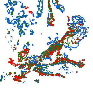
- Source Protection Zones [Merged] have been created as public facing outlines where common boundaries and overlaps (based on zone number) have been removed.
Source Protection Zones (SPZs) are defined around large and public potable groundwater abstraction sites. The purpose of SPZs is to provide additional protection to safeguard
drinking water quality through constraining the proximity of an activity that may impact upon a drinking water abstraction. This is part of an initial screening process in assessing impacts
to groundwater resources. Zones around location sites are defined by groundwater travel time to an abstraction. This is determined through applying Environment Agency groundwater
flow models run at the location of abstractions, inputting parameters such as flow direction, geology type, rainfall and hydrological boundaries. SPZs provide a visual representation of the increased risks
as you get closer to the abstraction. The following subdivisions are defined within SPZs: Zone 1: (Inner Protection Zone) - This zone is defined by a travel time of 50-days or less from
any point within the zone at, or below, the water table. Additionally, the zone has as a minimum a 50-metre radius. It is based principally on biological decay criteria and is designed to protect against the
transmission of toxic chemicals and water-borne disease. Zone 2: (Outer Protection Zone) - This zone is defined by the 400-day travel time from a point below
the water table. Additionally this zone has a minimum radius of 250 or 500 metres, depending on the size of the abstraction. The travel time is derived from consideration
of the minimum time required to provide delay, dilution and attenuation of slowly degrading pollutants. Zone 3: (Total catchment) - This zone is defined as the total area needed
to support the abstraction or discharge from the protected groundwater source. We’ve extended some zones to include areas where there is protective geology cover, such as clay.
This is because activities below the surface, such as deep drilling, could create pathways for pollutants to enter the groundwater. The SPZ maps show them as zones 1c, 2c and 3c. A further Zone 4,
or ‘Zone of Special Interest’ is occasionally defined for some groundwater sources.
These zones highlight areas (mainly on non-aquifers) where known local conditions mean that potentially polluting activities could impact on a groundwater source,
even though the area is outside the normal catchment of that source. Attribution statement: © Environment Agency copyright and/or database right 2016. All rights reserved. - Topic Category
- environment
- Keyword
- Keyword Value:groundwaterwater
resources management
aquifer
OpenData
Originating Controlled Vocabulary: GEMET - INSPIRE Spatial Data Themes (GEMET)
Originating Controlled Vocabulary Citation: 2008-01-01 - Temporal Extent
- from -1990-01-01 to --
- Dataset Reference Date
- Date:1990-01-01 -2021-06-18
Date Type: publication - Lineage
- Large potable groundwater abstractions are extracted from the National Abstraction Licence Database (NALD) and georeferenced as Source Protection Locations.
A groundwater flow model for relevant aquifer is run and classified into zones defined by travel time. Individual Source Protection Zones are merged and dissolved
by Zone number stripping out SPZ name. This is for National Security reasons.
IPR:
Product:
Date: - Extent
- West bounding longitude:-6.236
East bounding longitude:2.072
North bounding latitude:55.816
South bounding latitude:49.943 - Vertical Extent
- -
- Spatial Reference System
- OSGB36 - National Grid of Great Britain
- Spatial Resolution
- 1m
- Resource Locator
-
protocol: DSP:ESRI
name: SourceProtectionZonesMerged_Download
description: Source Protection Zones (Merged) Download
Download
protocol: WMS
name: SourceProtectionZonesMerged_WMS
description: Source Protection Zones (Merged) WMS
WMS
protocol: WFS
name: SourceProtectionZonesMerged_WFS
description: Source Protection Zones (Merged) WFS
WFS
protocol: WWW:LINK-1.0-http--link
name: Source_Protection_Zones_Merged_ESRI_REST_Endpoint
description: Source Protection Zones (Merged) - ESRI REST Endpoint
RESRI Rest Endpoint
protocol: http:
name: DSP_CUSTOMER_FORUM
description: Defra Data Services Platform Customer Forum - Layerfile for use by HCC internal staff: \\Geodata\EnvAgncy\Source_Protection_Zones_50k
- Format
- Open format | Shapefile (SHP)
- Responsible Organisation
- Environment Agency
Email :DSPcustomerforum@environment-agency.gov.uk
Role: Point of Contact. - Limitations on Public Access
- There are no public access constraints to this data. Use of this data is subject to the licence identified.
- Use Constraints
- This data is supplied without guarantee or any warranty as to the accuracy, currency or completeness,
and is provided as is, excluding any warranties of any
kind, either express or implied, to the fullest extent permitted by law,including (but not limited to) satisfactory quality or fitness for a particular purpose.
- Additional information
- Resource Identifier
- Conformity
- Commission Regulation (EU) No 1089/2010 of 23 November 2010 implementing Directive 2007/2/EC of the European Parliament and of the Council
as regards interoperability of spatial data sets and services.
2010-12-08
notEvaluated
Re-designing HCC Data for INSPIRE not done - Equivalent scale
- Bounding box
- 0.76, 0.22, 51.58, 52.10
- Quality scope
- Dataset
- Spatial representation type
- vector
- Character encoding
- UTF-8
- Data quality
- -
- Maintenance information
- maintenance and update frequency:irregular
- update scope:
- maintenance note:
- Metadata update date
- -2021-11-04
- Metadata Language
- English
- Metadata Point of Contact
- Environment Agency
Email :metadata@environment-agency.gov.uk - Resource Type
- 6 Dataset
- File Identifier
- Hierarchy level name
- dataset
- Parent identifier
- -
- Metadata standard name
- UK GEMINI
- Metadata standard version
- 2.3
- Review date
- -
- Attributes
-
Name Long Name Description
- OSGB36 National Grid Bounding Coordinates
- West: 486000 East: 552000 North: 245000 South: 189000
- More Information
- Change History
Open Government Licence