Metadata
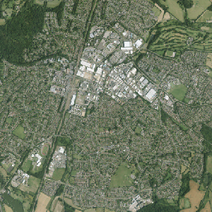
Aerial Photography 2020 - 2022
- Title
- AerialPhoto20202022
- Alternative Title
- AP20-22
-
- Dataset Language
- eng
- Abstract
- APGB (Aerial Photography for Great Britain) is a ground-breaking agreement between the Department for Buisiness and Trade (formerly BEIS) which gives PSGA Members access to high quality aerial imagery (25cm or 12.5cm resolution
where available). It also allows for colour infra-red (CIR) imagery and tinted shaded relief data to be consumed by PSGA Members.
- Topic Category
- imageryBaseMapsEarthCover
- Keyword
- Keyword Value: Aerial Photography 2020 2022
Originating Controlled Vocabulary: GEMET - INSPIRE Spatial Data Themes (GEMET)
Originating Controlled Vocabulary Citation: 2008-01-01
- Temporal Extent
- from 2020 to 2022
- Dataset Reference Date
- Date: 2020 to 2022
Date Type: Creation
- Lineage
- Data collected via Aerial Surveys conducted by Bluesky International Ltd and Getmapping Plc, on a rolling three year update programme.
- Extent
- Hertfordshire County
- Vertical Extent
- -
- Spatial Reference System
- OSGB36 - National Grid of Great Britain
- Spatial Resolution
- 12.5cm
- Resource Locator
-
- Layerfile for use by HCC internal staff:\Geodata\AirPhoto\year20202022
- Format
- image/Tiff
- Responsible Organisation
- Getmapping plc
Email :custservice@getmapping.com
Role: Resource Provider, Distributor, Originator, Point of Contact, Processor, Publisher, Author.
- Limitations on Public Access
- restricted public access to comply with licencing and intellectual property rights
- Use Constraints
- This data is copyright controlled, the licence holder is Hertfordshire County Council.
All reproductions must display the following acknowledgement: © Getmapping plc and Bluesky International Limited 2024
IPR in data derived from these aerial images is not claimed by ©Getmapping plc and Bluesky International Limited but is retained by Hertfordshire County Council.
Please check with the Corporate GIS Team at GIS@hertfordshore.gov.uk before including the data in any outputs.
You are not permitted to copy, sub-licence, distribute or sell any of this data to third parties in any form.
Use of the data is available to any organisation that is a member of the PSGA (Public Sector Geospatial Agreement) or any UK academic institution via Edina's subscription Digimap service. It is not currently commercially available.
- This data is supplied without guarantee or any warranty as to the accuracy, currency or completeness,
and is provided as is, excluding any warranties of any
kind, either express or implied, to the fullest extent
permitted by law,including (but not limited to) satisfactory quality or fitness for a particular purpose.
- Additional information
- Resource Identifier
- Conformity
- Commission Regulation (EU) No 1089/2010 of 23 November 2010 implementing Directive 2007/2/EC of the European Parliament and of the Council
as regards interoperability of spatial data sets and services.
2010-12-08
notEvaluated
Re-designing HCC Data for INSPIRE not done
- Equivalent scale
- Bounding box
- 0.76, 0.22, 51.58, 52.10
- Quality scope
- Dataset
- Spatial representation type
- vector
- Character encoding
- UTF-8
- Data quality
- -
- Maintenance information
- maintenance and update frequency:notPlanned
- update scope:
- maintenance note: Latest aerial imagery available through WMS service provided to the council
- Metadata update date
- --
- Metadata Language
- English
- Metadata Point of Contact
- Hertfordshire County Council - Corporate GIS Team
Email :gis@hertfordshire.gov.uk
- Resource Type
- 6 Dataset
- File Identifier
- Hierarchy level name
- dataset
- Parent identifier
- -
- Metadata standard name
- UK GEMINI
- Metadata standard version
- 2.3
- Review date
- -
- Attributes
-
| Name |
Long Name |
Description |
|
|
|
|
|
|
|
|
|
|
|
|
|
|
|
|
|
|
|
|
|
- OSGB36 National Grid Bounding Coordinates
- West: 486000 East: 552000
North: 245000 South: 189000
- More Information
- Change History