Metadata
Aerial Photography 2000
- Title
- AerialPhoto2000
- Alternative Title
- APS2000
-
- Dataset Language
- eng
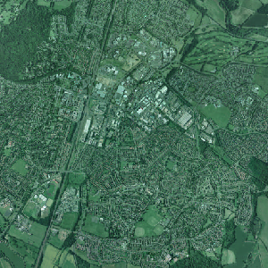
- Abstract
- Vertical,ortho-rectified aerial imagery covering all of Hertfordshire plus certain additional areas including Luton and Stansted Airports and part of North London
- Topic Category
- imageryBaseMapsEarthCover
- Keyword
- Keyword Value: Aerial Photography 2000
Originating Controlled Vocabulary: GEMET - INSPIRE Spatial Data Themes (GEMET)
Originating Controlled Vocabulary Citation: 2008-01-01
- Temporal Extent
- from 2000-04 to 2000-07
- Dataset Reference Date
- Date: 2000
Date Type: Creation
- Lineage
-
Specification: Colour, vertical aerial photography to RICS specification, Quality: The photography shall be of an image quality and geometry suitable for photogrammetric mapping and raster scanning.
Its intended use includes land use interpretation, planning and engineering applications.Camera: Air survey camera,
Lens unit: 152mm focal length, calibrated, cleaned, tested and certified, Forward-motion compensator:Yes, Nominal scale: 1:10000, Flight lines: Straight and level, aligned North/South,
Lateral overlap 25% (between 15% and 35%),Forward overlap: 60% (between 55% and 65%), Camera orientation: Camera tilt shall not normally exceed 2 degrees and crab shall not exceed 5 degrees
Product: Orthophotography, Geo-referenced raster image, Minimum resolution True 1200dpi, Pixel/ground resolution: 25cm, Maximum viewing scale: 1:1250, Number of colours:24 bit
2000
To read about the methodology used to obtain the 2000 AP please see here
- Extent
- Hertfordshire 1,664 sq km
- Vertical Extent
- -
- Spatial Reference System
- OSGB36 - National Grid of Great Britain
- Spatial Resolution
- True 1200dpi
- Resource Locator
-
- Layerfile for use by HCC internal staff: \Geodata\AirPhoto\year2000
- Format
- Image/Tiff
- Responsible Organisation
- Bluesky and Infoterra
Email :info@blueskyworld.com
Role: Resource Provider,Owner, Distributor, Originator, Author.
- Limitations on Public Access
- licence
- Use Constraints
-
The agreement allows the use of the data as follows: -
1. The use of the data by any employee of the licence holder for internal use.
2. Use by the licence holder on own Intranet facilities at full resolution.
3. Use by the licence holder on Web Site at full resolution provided the Web
Site is wholly owned by a public sector organisation. Use of the data on
any other Web Site is strictly prohibited.
4. Use of the data in the creation of internal documents.
5. Use of the data for illustration within non-profit making publicity material for
the public.
6. Use of the data by third parties where formal Partnership Agreements exist
for analysis and creation of documents and Publicity material for non-profit
making activities. The data licence for the third party would end at the
cessation of the Partnership.
7. Use of the data within Libraries (to members of the public for specific
research purposes within a research area on one machine. Hard copy
prints outs must be black and white only and no copying of the digital data
is permitted.)
8. Use within licence holder educational establishments for teaching
purposes.
9. The number of copies that can be made by the licence holder for internal
use is unlimited.
Please note, any reproductions of the photography whether hard copy or
digital must have the copyright statement ‘Copyright GeoPerspectives’ visible
on or near the image.
For the avoidance of doubt, the Product shall remain the exclusive property of
the Publishers Bluesky and Infoterra.
This data is supplied without guarantee or any warranty as to the accuracy, currency or completeness,
and is provided as is, excluding any warranties of any
kind, either express or implied, to the fullest extent
permitted by law,including (but not limited to) satisfactory quality or fitness for a particular purpose.
<\dd>
- Additional information
- Resource Identifier
- Conformity
- Commission Regulation (EU) No 1089/2010 of 23 November 2010 implementing Directive 2007/2/EC of the European Parliament and of the Council
as regards interoperability of spatial data sets and services.
2010-12-08
notEvaluated
Re-designing HCC Data for INSPIRE not done
- Equivalent scale
- 1:10000
- Bounding box
- 0.76, 0.22, 51.58, 52.10
- Quality scope
- Dataset
- Spatial representation type
- vector
- Character encoding
- UTF-8
- Data quality
- -
- Maintenance information
- maintenance and update frequency:notPlanned
- update scope:
- maintenance note:
- Metadata update date
- --
- Metadata Language
- English
- Metadata Point of Contact
- Hertfordshire County Council - Corporate GIS Team
Email :gis@hertfordshire.gov.uk
- Resource Type
- 6 Dataset
- File Identifier
- Hierarchy level name
- dataset
- Parent identifier
- -
- Metadata standard name
- UK GEMINI
- Metadata standard version
- 2.3
- Review date
- -
- Attributes
-
- OSGB36 National Grid Bounding Coordinates
- West: 486000 East: 552000
North: 245000 South: 189000
- More Information
- Change History