Metadata
Acorn
- Title
- Acorn (Output Area)
- Alternative Title
- Acorn OA, ACORN OA
- Dataset Language
- eng
- Abstract
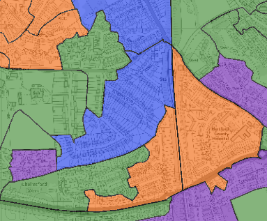
- Acorn Geodemographic data supplied under licence from CACI ltd. Acorn is a geodemographic classification that segments the population according to their lifestyle, life stage and affluence. It can be useful for better understanding our residents, knowing how best to communicate with them and for informing service planning.
This dataset is an Output Area (2021) aggregration for every household in Hertfordshire coded by Acorn category, and shows the modal (most common) category for each Output Area. This data is strictly for use only by internal employees and any sharing or restriction queries should be directed to kellie.blanchard@hertfordshire.gov.uk
- Topic Category
- Society
- Keyword
- Keyword Value: People
Originating Controlled Vocabulary: Integrated Public Sector Vocabulary (IPSV)
Originating Controlled Vocabulary Citation: Version 2.00 - 2012-08-05
Keyword Value: Population distribution and demography
Originating Controlled Vocabulary: GEMET - INSPIRE Spatial Data Themes (GEMET)
Originating Controlled Vocabulary Citation: 2008-06-01 - Temporal Extent
- from
- Dataset Reference Date
- Date: 08/08/2023
Date Type: Revision Annually - Lineage
- Data collected and processed by CACI from a number of sources including open government registers, private sector databases and lifestyle surveys.
- Extent
- Hertfordshire County
- Vertical Extent
- -
- Spatial Reference System
- OSGB36 - National Grid of Great Britain
- Spatial Resolution
- 1m
- Resource Locator
- Internal Viewer: Acorn Viewer
- Layerfile for user by HCC internal staff:J:\Geodata\Other\Acorn
- Format
- ESRI/SDE
ESRI/Layer File - Responsible Organisation
- Hertfordshire County Council - Community Intelligence and Data Science Team
Email :Kellie.Blanchard@hertfordshire.gov.uk
Role: Custodian, Distributor, Point of Contact, Publisher, Contract Management. - Limitations on Public Access
- There are licence restrictions with what can and cannot be shared outside of HCC. Please do not make copies of the maps or share data where individual Acorn Categories/Types can be identified for a property which are intended to be shared externally.
If you would like to share any Acorn maps or data, please contact Kellie Blanchard to discuss your requirements. For further information about geodemographics in Hertfordshire, please see the collaboration page on the intranet or contact Kellie.Blanchard@hertfordshire.gov.uk.
- Use Constraints
- Licensed under the Public Sector Geospatial Agreement.
You must use the appropriate Copyright Acknowledgement;
Please Source: Acorn, CACI Ltd,2021 - Additional information
- For further information and to be given access to the Acorn collaboration page to access supporting documentation/resources please email Kellie.Blanchard@hertfordshire.gov.uk
- Resource Identifier
- Acorn
- Conformity
- Commission Regulation (EU) No 1089/2010 of 23 November 2010 implementing Directive
2007/2/EC of the European Parliament and of the Council as regards interoperability of
spatial data sets and services.
2010-12-08
notEvaluated
Re-designing HCC Data for INSPIRE not done - Equivalent scale
- 3000
- Bounding box
- -0.71, 0.19, 51.62, 52.06
- Quality scope
- Dataset
- Spatial representation type
- Vector
- Character encoding
- UTF-8
- Data quality
- -
- Maintenance information
- Maintenance and update frequency: annual refresh in April / May
- Metadata update date
- 2021-07-19
- Metadata Language
- English
- Metadata Point of Contact
- Hertfordshire County Council - Community Intelligence and Data Science Team
Email : Kellie.Blanchard@hertfordshire.gov.uk - Resource Type
- 6 Dataset
- File Identifier
- Acorn
- Hierarchy level name
- dataset
- Parent identifier
- -
- Metadata standard name
- UK GEMINI
- Metadata standard version
- 2.3
- Review date
- 2022-05
- Attributes
-
Name Long Name Description OA11CD Output Area 2011 Code A unique code used to identify Output Areas (2011) OA_Modal_Category OA Modal Category The most common Acorn category for households within a specific Output Area. OA_Household_Modal_Number OA Household Modal Number The total number of dwellings within an OA which make up the modal Acorn category for that OA OA_Modal_Percentage OA Modal Percentage The percentage of dwellings within an OA which make up the modal Acorn category for that OA CACI_HH_ACORN_Cat_Name_URL CACI Household Acorn Category URL A URL linking off to a summary description of each Acorn Category stored within Portal for ArcGIS (used in the Acorn Viewer popups) - OSGB36 National Grid Bounding Coordinates
- West: 486000 East: 552000 North: 245000 South: 189000
- More Information
- Change History